9th Nov, 2021 10:00
Fine Books & Works on Paper
Moll (Herman)
Moll (Herman)
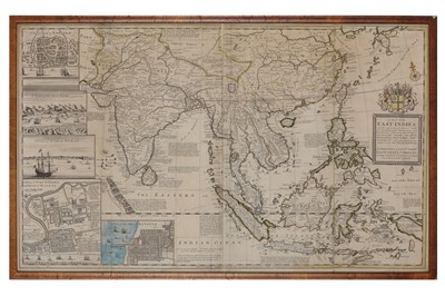
A map of the East Indies with adjacent countries, with the settlements, factories and territories, explaning what belongs to England, Spain, France, Holland, Denmark, Portugal &c..., hand-coloured in outline, cartouche with East India Company coat-of-arms, inset views of Bantam, Goa and Surat, inset maps of Fort St. George at Madras and Batavia, includes the southern portion of China, Tibet, Taiwan, a portion of Korea and Japan, on two joined sheets, creasing, 61 x 102cm, framed & glazed, c.1715.
***Having made his name in London, Moll’s birthplace and nationality remain unknown. He was presumably Dutch or German.
Sold for £2,500
Includes Buyer's Premium
Do you have an item similar to the item above? If so please click the link below to request a free online valuation through our website.


