24th May, 2023 11:00
Books & Works on Paper
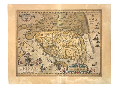
Ortelius (Abraham) Chinae, olim Sinarum regionis nova descriptio
Ortelius (Abraham)
Chinae, olim Sinarum regionis nova descriptio, First State, [Van den Broecke, no.164, 1584L93], from the Theatrum Orbis Terrarum, Latin text verso, hand-coloured, browning and discolouration, small wormtrail at centre, 442 x 565mm, Antwerp, 1584.
***“When this map appeared, it was by far the most accurate one of China. Japan is shown on a curious curved projection reminiscent of Poruguese charts of the period with Honshu dissected along the line of Lake Biwa. The Great Wall is shown but with 400 miles only; its length is grossly underestimated. The Tartar ‘yurts’ are dotted across the plains and steppes of Central and East Asia.”
Do you have an item similar to the item above? If so please click the link below to submit a free online valuation request through our website.


